Trail Coupling La Plaine - Montée des Pellerinières bis - Photo

Montée des Pellerinières bis

© OpenStreetMap contributors
Length
Length
20 km
Max alt
Max alt
208 m
Uphill gradient
Uphill gradient
171 m
Km-Effort
Km-Effort  
23 km
Min alt
Min alt
116 m
Downhill gradient
Downhill gradient
172 m
Boucle
Boucle
Yes
Creation date :
2021-10-16 06:28:26.303
Updated on :
2021-10-16 07:44:31.983

(0 Reviews)

Coupling
Coupling
3h00
Difficulty : Easy

Scan this QR Code to open this trail in the SityTrail application

FREE GPS app for hiking

Logo SityTrail SityTrail

IGN / Geographical institutes

Download SityTrail from the App Store Download SityTrail from Google Play

Logo SityTrail SityTrail World

The world is yours!

Download SityTrail from the App Store Download SityTrail from Google Play Download SityTrail on Huawei AppGallery

About

Trail Coupling of 20 km to be discovered at Pays de la Loire, Maine-et-Loire, La Plaine. This trail is proposed by Bruno Bailliache.

Elevation profile

Positioning

Country:
France
Region :
Pays de la Loire
Department/Province :
Maine-et-Loire
Municipality :
La Plaine
Location:
Unknown
Start:(UTM)
679116 ; 5214462 (30T) N.

Trails nearby

Trail Walking Somloire - rando somloire - Photo
Walking
mmlahaye

Walking

Very easy
Somloire, Pays de la Loire, Maine-et-Loire, France
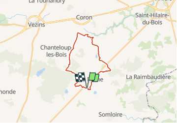
10.5 km | 11.6 km-effort
2h 17min
Yes


Close
My subscriptions